Building date:
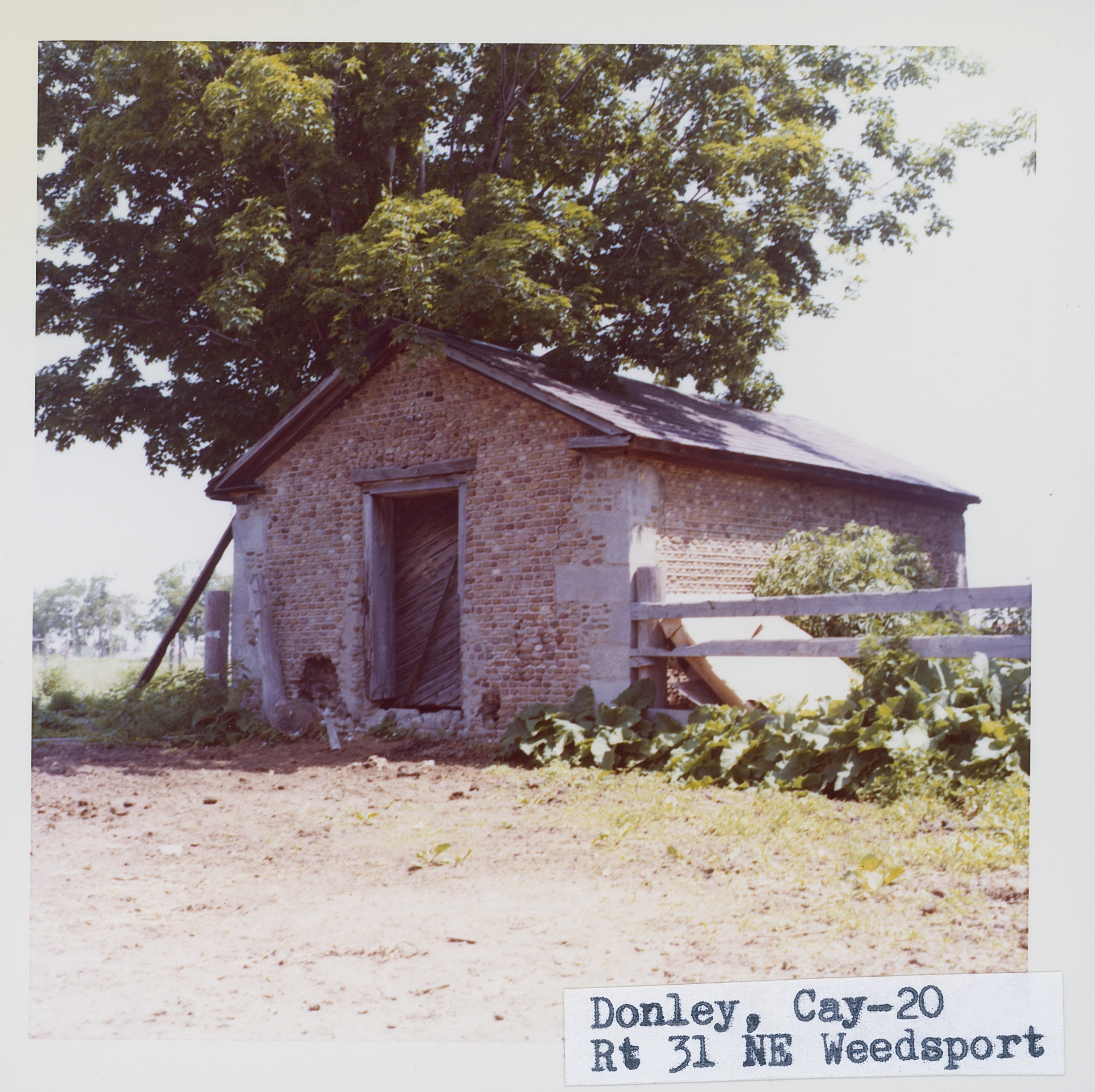
Original use: Stable
Corner structures: Variable gray limestone
Mortar application and content: Vertical heavy. Horizontal mortar protrudes, while the verticals are set back behind the upper horizontal and slope outward toward the lower horizontal.
Types and uses of stones: various sizes, shapes and colors
Types and choice of windows: Wood lintels
Structures with similar masonry details:
Masons who worked on building:
Unique features:
Map views courtesy Google Maps. Address is Google Earth possible; 43°03'23.62"N 76°32'57.68"W. Current owner of record, Donnelley as of date (YMD) 190310.
Editor's Note: The street address and approximate structure location have been confirmed. The Roudabush Survey does not state a street address. Richard Palmer states a street address of 2887 which does not correspond with the location marked on the Town of Brutus map by Roudabush. Google Maps satellite view was not helpful. Correspondence dated FEB 27,2019 has been sent to the Brutus Town Historian requesting address confirmation and status of the structure.
Per Richard Palmer on 10MAR2019: The old cobblestone structure which faces east about 50 feet behind the north side of the brick house was still there last summer in the underbrush.
Town of Brutus and Cayuga County Maps
Additions to Schmidt's list. On Route 31, north of Weedsport, there is a small cobblestone which serves as a stable. It is in the back of the property, and is not easily visible from the road. It has been extensively repaired, but the variable quoins and part of the south wall appear to be original. Quoins are gray limestone. Stones are of various sizes, shapes and colors. Horizontal mortar protrudes, while the verticals are set back behind the upper horizontal and slope outward toward the lower horizontal. Roudabush Survey page 45
Smothered by under brush are the ruins of this this old farm storage shed or granary on an early farm at 2887 Route 31, Clinton Road, Weedsport, north side. It measures 15 by 22 feet. This building is a short distance from this lovely old farm-house. See photographs marked with superscript ¹. Richard Palmer blog.
- "Cayugas Cobblestones", by Ward O'Hara 1991
- Pages 30 - 31
 Bru_2_1.jpg | 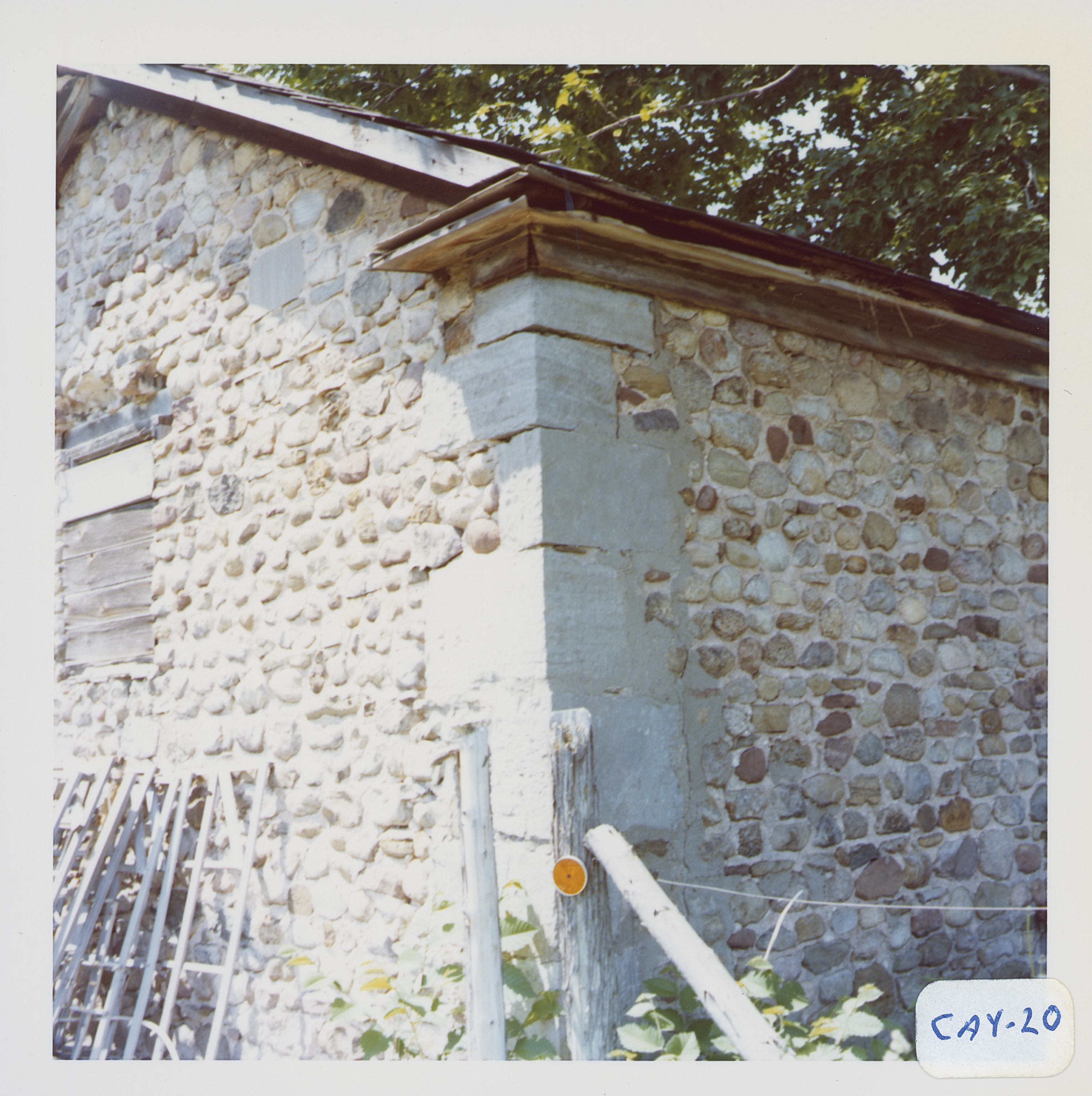 Bru_2_2.jpg | 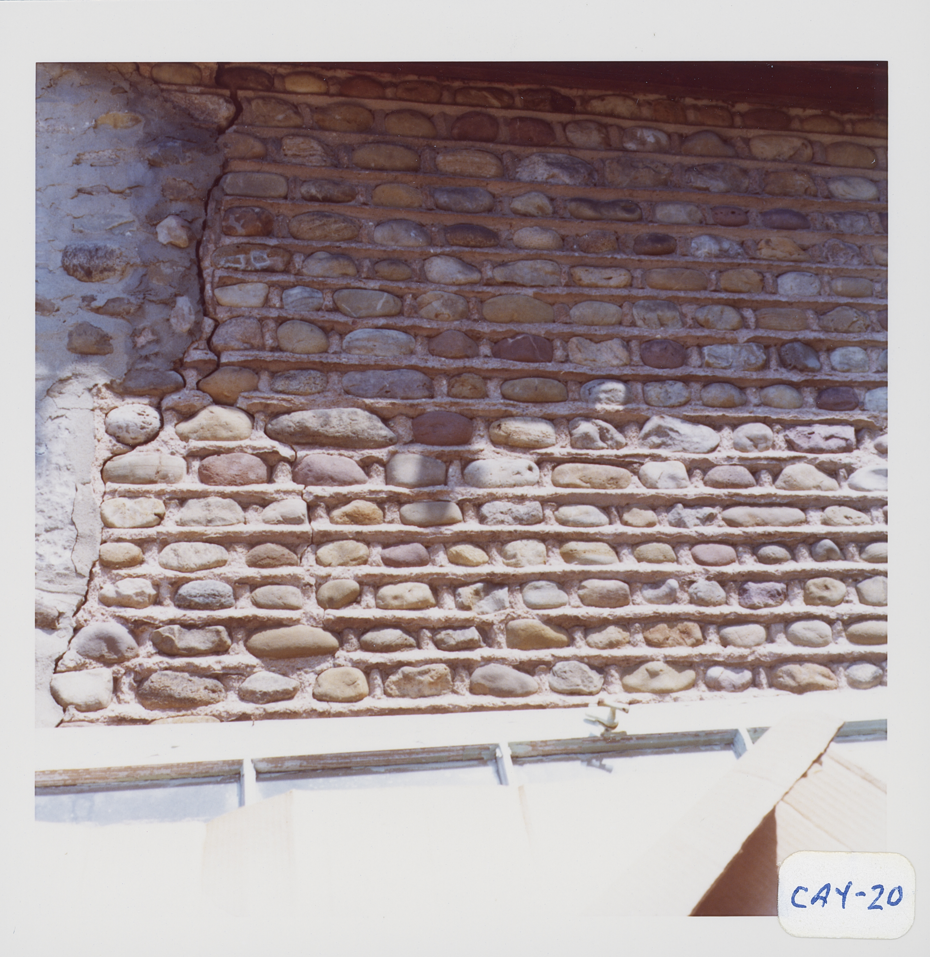 Bru_2_3.jpg |  Bru_2_4.jpg |
 Cobblestone shed, 2887 Route 31, Weedsport.jpg ¹ |  2887 Route 31, Weedsport.jpg) (2) 2887 Route 31, Weedsport.jpg ¹ |  2887 Route 31, Weedsport.jpg ¹ |
¹ Photographs courtesy Richard Palmer.
